1897 Map of Armenia, Assyria, Mesopotamia, Babylonia, and Media
August 1, 2022
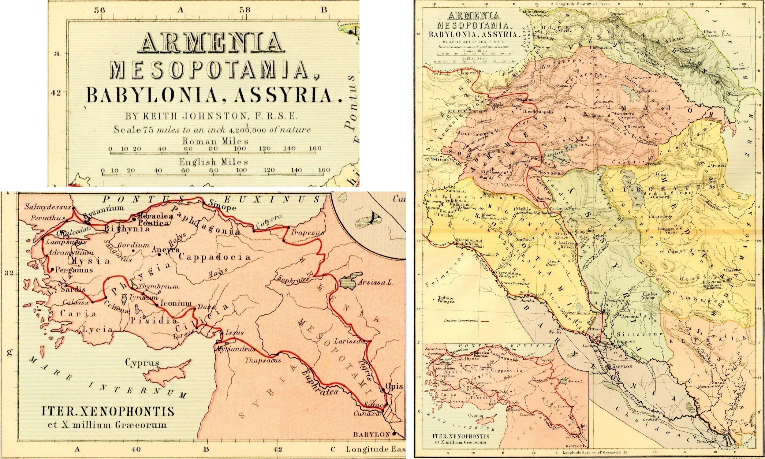
This month’s Artifact of the Month features a map of ancient Asia Minor made by the W. & A.K. Johnston firm in the mid to late 1800s. The map shows the historical regions of Armenia Maior, Mesopotamia, and Babylonia, among others. There is a note in pencil along the edge of the sheet indicating 1897 as a possible date of publication, but further research has yielded another date of 1877 based on the atlas published by the firm in that year as well as the fact that the cartographer, Keith Johnston, passed away before 1897. Thus, this map could be titled “Map of Armenia, Mesopotamia, Babylonia, and Assyria, showing the route of Xenophon and the Ten Thousand” as featured in The Unrivalled Classical Atlas engraved by Keith Johnston, FRSE. It is printed and engraved in a variety of pastel colors delineating regions while the route of the Ten Thousand is rendered in a bright red.
W. & A.K. Johnston was a Scottish engraving and publishing firm established in 1826 in Edinburgh by two brothers: Sir William Johnston and Alexander Keith Johnston. The cartographical firm quickly became acclaimed for the detail and accuracy of their atlases that incorporated not only geography but also geology and meteorology, and the brothers were appointed as engravers for the British monarchy. This was an exceptional honor during the Victorian period because the British Empire spanned multiple continents and was still expanding, so there was significant interest in mapping the world and the details of each environment and climate despite the lack of satellite photography that cartographers now rely upon. In fact, Alexander Keith Johnston’s son later passed away in 1879 in Tanzania during an expedition to survey the region. This map demonstrates the W. & A.K. firm’s importance in their field and the breadth of topics they covered in their thematic atlases – not only current to their time but also historical and academic.
Category: Archival Materials
Region of Origin: Asian
Keywords:
Map