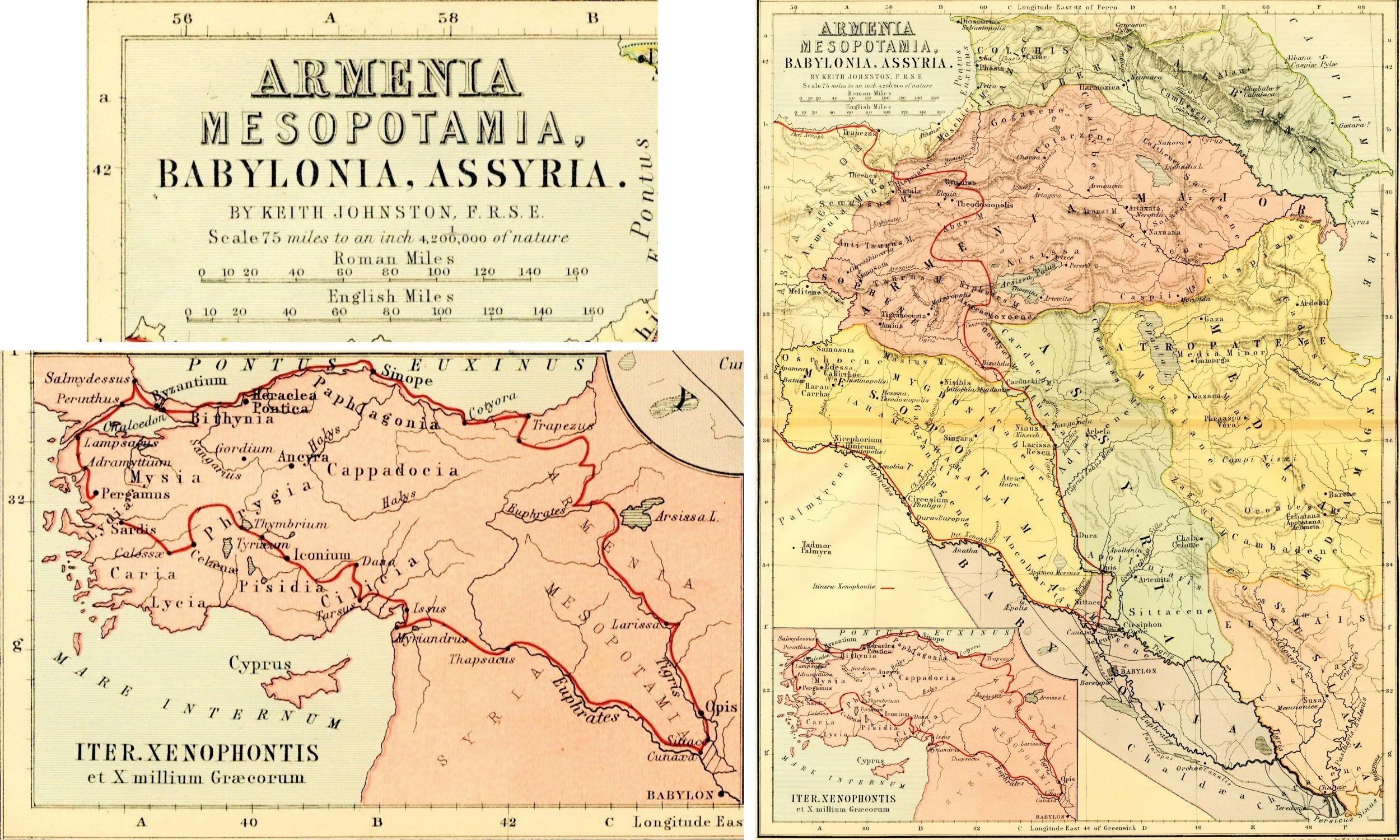
1897 Map of Armenia, Assyria, Mesopotamia, Babylonia, and Media
1897 Map of Armenia, Assyria, Mesopotamia, Babylonia, and Media
August 1, 2022
This month’s Artifact of the Month features a map of ancient Asia Minor made by the W. & A.K. Johnston firm in the mid to late 1800s. The map shows the historical regions of Armenia Maior, Mesopotamia, and Babylonia, among others. There is a note in pencil along the edge of the sheet indicating 1897 as a possible date of publication, but further research has yielded another date of 1877 based on the atlas published by the firm in that year as well as the fact that the cartographer, Keith Johnston, passed away before 1897.
Category:
Region of Origin:
Keywords: